Drone Progress Documentation for Construction Projects
Consistent aerial documentation helps teams track milestones, improve reporting, reduce disputes, and maintain a clear visual record of site conditions over time.
Browse practical articles written for property owners, contractors, developers, real estate professionals, and teams that need clean documentation and reliable aerial coverage in DeLand, Volusia County, and Central Florida.
Consistent aerial documentation helps teams track milestones, improve reporting, reduce disputes, and maintain a clear visual record of site conditions over time.
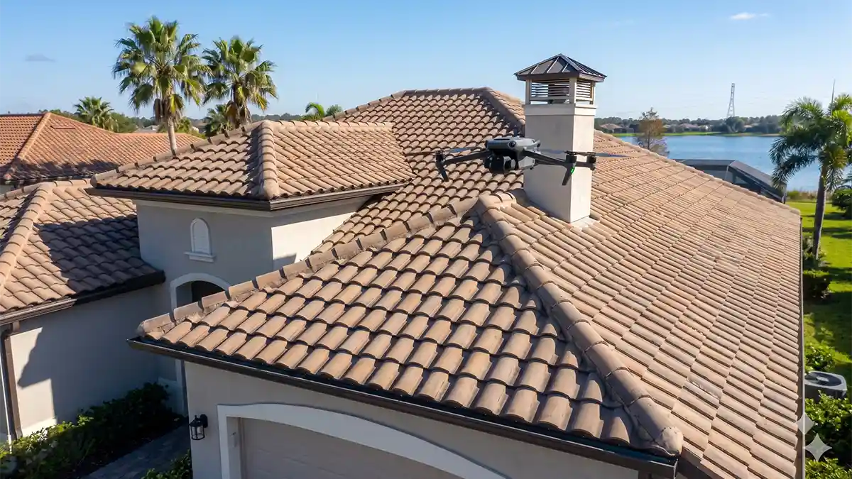
How drone roof documentation reduces risk, improves visual records, and supports faster property and insurance workflows.
Read article →
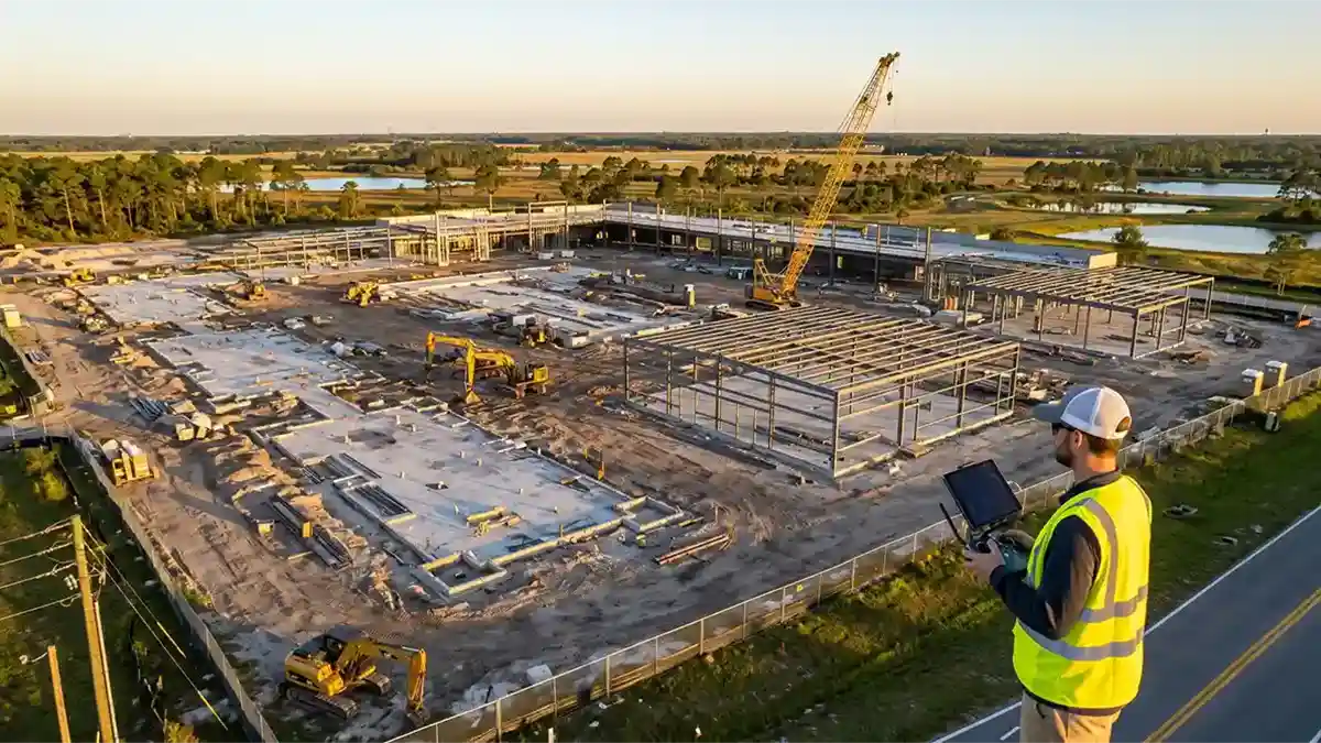
See how recurring aerial captures help teams track progress, communicate clearly, and maintain a strong project record.
Read article →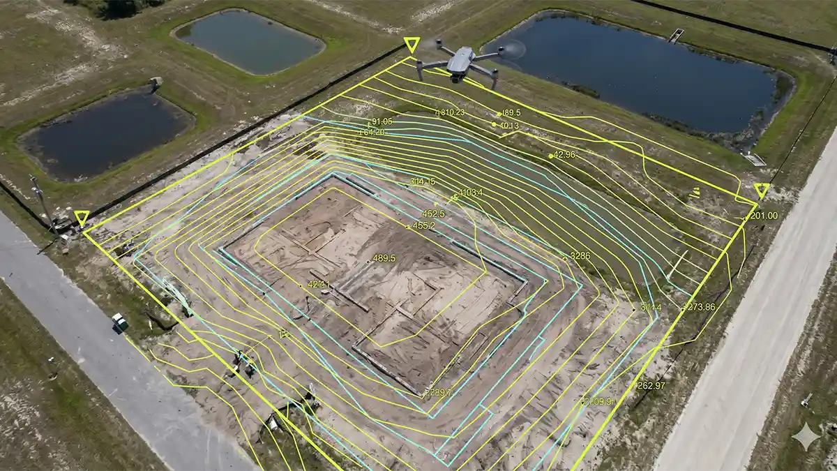
A practical introduction to orthomosaics, 3D models, and how drone mapping supports construction and land documentation workflows.
Read article →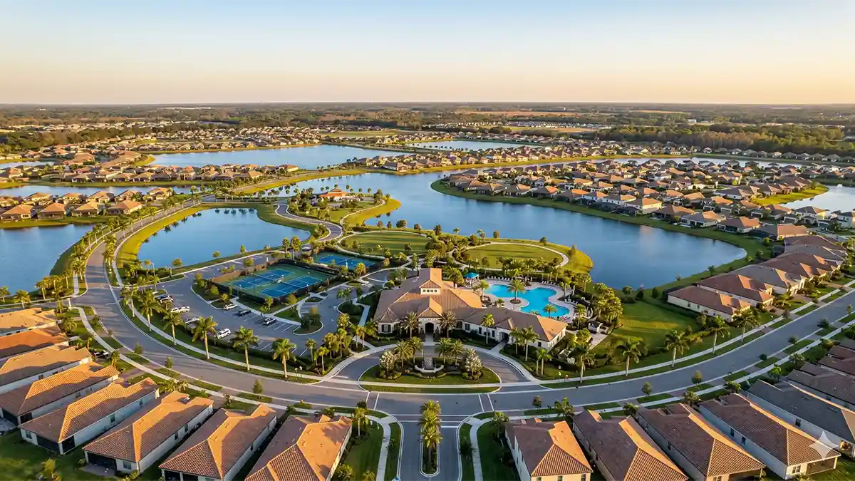
Aerial community overviews can support planning, presentation, and buyer-facing marketing for HOAs and managed properties.
Read article →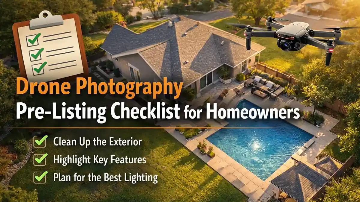
A straightforward checklist to prepare a property before aerial photography and help listing visuals look cleaner and stronger.
Read article →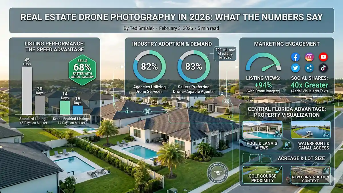
A stats-focused look at why aerial visuals continue to matter for listings, marketing performance, and property presentation.
Read article →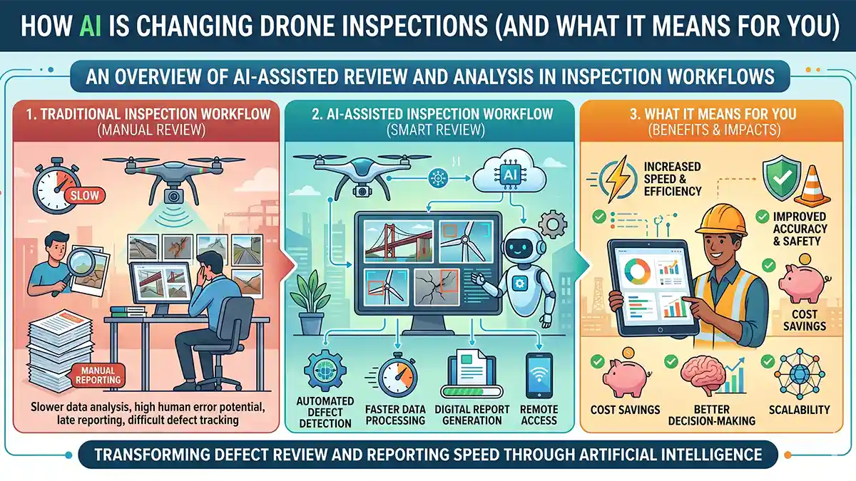
An overview of how AI-assisted review and analysis can change documentation workflows, defect review, and reporting speed.
Read article →
A plain-language summary of the topic and why it matters to drone owners, buyers, and commercial operators.
Read article →
A practical look at BVLOS rule discussions and what they could mean for commercial drone operations.
Read article →
Why recurring aerial updates are useful for stakeholders, internal reporting, and keeping project documentation organized.
Read article →
How pre-storm aerial documentation can help preserve a clear record of roof and property condition before damage occurs.
Read article →
A concise overview of how aerial visuals help properties show setting, lot context, and listing appeal more clearly.
Read article →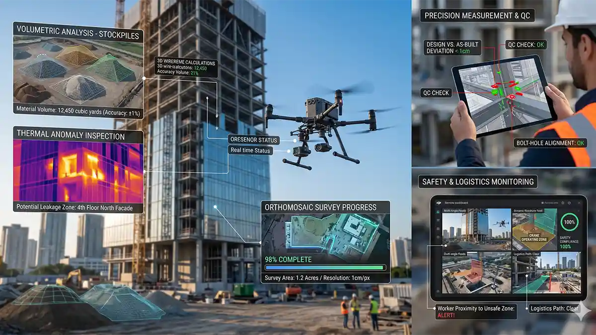
An introduction to the broader value of drones in modern construction visibility, progress review, and documentation.
Read article →This plain archive list keeps every blog entry directly linked in the page source for users and search engines.
Based in DeLand and serving Central Florida for aerial imaging, documentation, and inspection support.