Homeowners
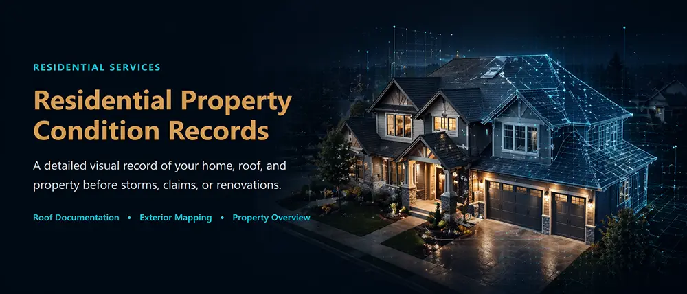
Residential Property Photo Records
From $249
Roof, exterior, property, and optional 360-degree interior records before storms, roof work, or renovations.
Book Residential RecordSouthview Drone Imaging provides FAA Part 107 certified aerial imaging and visual documentation for residential, commercial, construction, asset, and property-record needs across DeLand, Volusia County, and Central Florida. Deliverables are organized for planning, review, records, and qualified-professional consultation.
Homeowners can book directly. Construction and managed-property clients can review starting package ranges before requesting a plan.
Roof, exterior, property, and optional 360-degree interior records before storms, roof work, or renovations.
Book Residential RecordOne-time, monthly, biweekly, or weekly progress records for jobsites and owner updates.
View Construction PackagesCommon-area, exterior, amenity, and storm-season records for managed properties.
View HOA / Facility Plans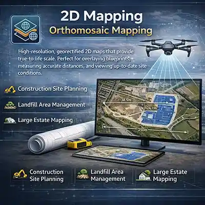
High-resolution, corrected overhead visuals for site reference. Useful for visual site review, overlay discussions, planning support, and viewing up-to-date site conditions.
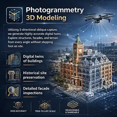
Using structured multi-angle capture, we generate detailed 3D visual models. Explore structures, facades, and site features from multiple angles and a safe position.
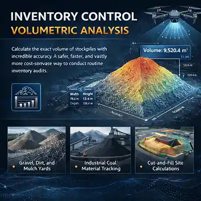
Support stockpile and material tracking with aerial documentation, visual comparisons, and approximate non-certified stockpile comparisons when appropriate. A practical way to support routine inventory review.
Keep personnel safely on the ground while our aerial imaging workflows capture the important imagery you need. From repeatable flight paths over active construction sites to extreme zoom capabilities for high-voltage towers, we deliver clear visibility into your most valuable assets.
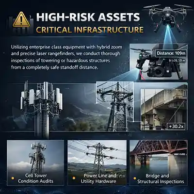
Using professional aerial imaging workflows with high-detail image capture methods, we capture detailed inspection-support imagery of towering or hard-to-access structures from a safe standoff distance.
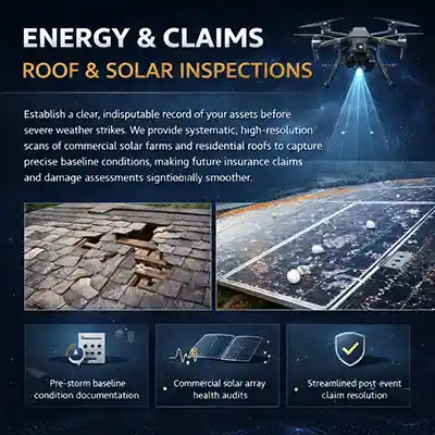
Establish a clear visual record of your assets before severe weather strikes. We provide systematic, high-resolution imagery of commercial solar farms and residential roofs to document visible baseline conditions and support future insurance or maintenance review.
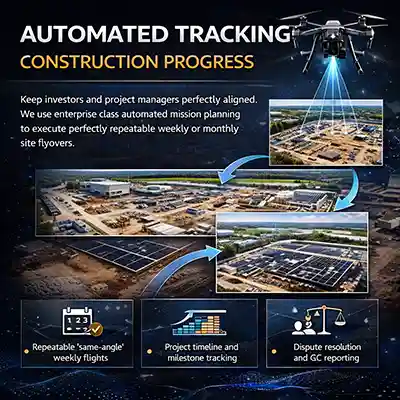
Keep investors and project managers aligned. We use structured mission planning to capture repeatable weekly or monthly site flyovers.
Tell us what you’re trying to accomplish (progress documentation, inspection-support imagery, marketing, insurance-related property records, or a custom job), where it’s located, and your ideal timeline. We’ll respond with a straightforward plan and pricing.