Before Storm Season
Create a visual roof and exterior baseline before wind, rain, hail, or debris events.
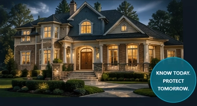
Central Florida Homeowner Documentation
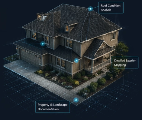
Create a dated visual record of your roof, exterior, and property before storm season, roof work, repairs, renovations, purchase decisions, or long-term maintenance planning. Southview Drone Imaging combines drone photography, ground-level images, organized digital delivery, and optional 360-degree interior photo records for Central Florida homeowners.
Visible photo documentation only. Not a home inspection, roof certification, insurance adjustment, engineering evaluation, appraisal, legal survey, code inspection, or damage assessment.
Quick Answer
It is a dated visual baseline of visible roof, exterior, property, and optional interior conditions. Homeowners use it before storm season, repairs, roof replacement, renovations, purchase reviews, maintenance planning, or claim-discussion preparation. It helps organize visual records, but it does not diagnose damage, certify the roof, determine insurance coverage, or replace licensed professional evaluations.
Why Homeowners Schedule It
Most homeowners do not need artistic drone photos. They need clear, organized property documentation before weather, repairs, projects, or ownership decisions create questions.
Create a visual roof and exterior baseline before wind, rain, hail, or debris events.
Document the property before roof repair, roof replacement, gutter work, or contractor staging.
Record exterior layout, access points, drainage areas, trees, pool areas, and outdoor features.
Keep dated roof, exterior, and property imagery in an organized customer portal for future reference.
What You Get
Each package is designed for homeowner recordkeeping, contractor conversations, pre-storm files, project planning, and future comparison.
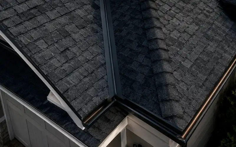
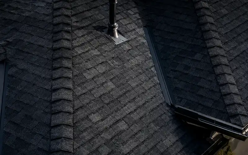
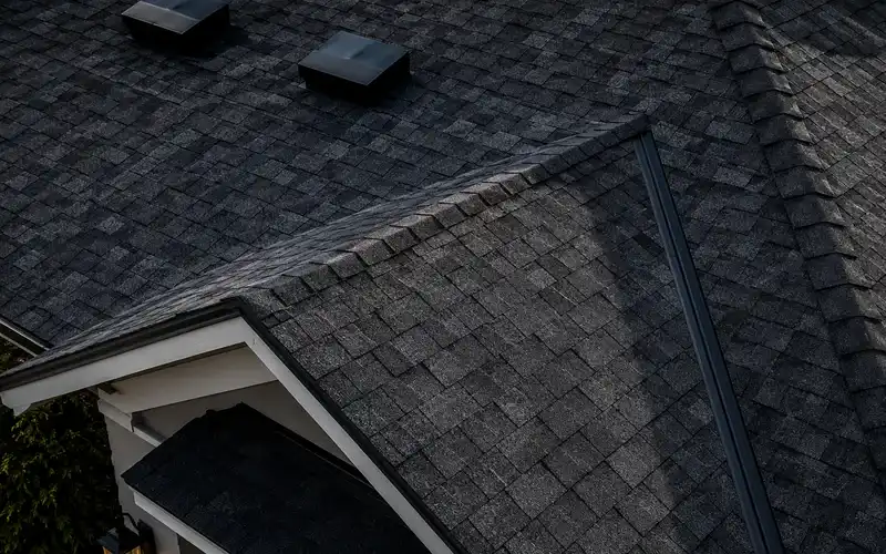
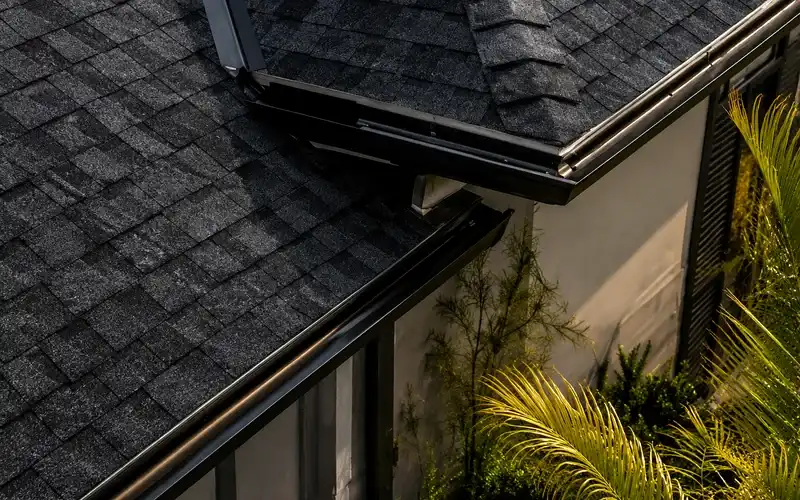
Visible roof surfaces, edges, gutters, vents, flashing, roof penetrations, and other visible roof features.
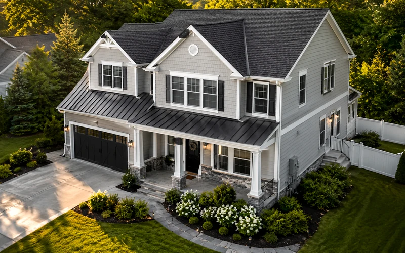
Front, rear, and side views including walls, windows, doors, patios, pool areas, fencing, and other exterior features.
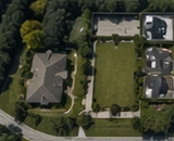
Driveways, landscaping, drainage areas, trees, yard layout, detached structures, and outdoor site context.
Organized digital delivery, off-site backup, and optional long-term storage for homeowner records.
Simple Process
Select Essential, Complete, or Premium based on property size, documentation detail, and long-term record needs.
We confirm the property address, access notes, airspace considerations, exterior areas of concern, and safe flight conditions.
Drone and ground-level images are captured without walking on the roof. Optional 360-degree interior photo records can be added.
Your images are delivered in an organized gallery or customer portal with package-level backup terms.
Packages
Choose the level of residential documentation that fits your property, project, storm-preparation needs, and long-term recordkeeping goals.
Starter Record
$249
Best for homeowners who want a simple roof and exterior baseline before storm season, repairs, or maintenance work.
Choose this if: you have one standard home and want a basic dated exterior record.
Most Popular
$399
Best for homeowners who want a fuller visual baseline before storms, repairs, renovations, maintenance planning, or claim-discussion reference.
Choose this if: you want the best all-around homeowner record.
Premium Record
$649
Best for larger homes, higher-value properties, larger lots, renovations, detached structures, and future comparison records.
Choose this if: your property has more exterior features or you want deeper long-term documentation.
Optional Add-Ons
Add-ons are useful for larger properties, multiple structures, faster delivery, interior photo records, follow-up comparison visits, contractor sharing, or longer-term storage.
Southview Drone Imaging is FAA Part 107 certified and insured. Property condition records are created from visible imagery only. We do not perform home inspections, insurance adjusting, engineering evaluations, appraisals, roof certifications, land surveys, code inspections, or damage assessments.
Best Times to Schedule
The service is most valuable before conditions change. A current visual baseline can make future comparisons easier for your own records, project planning, contractor conversations, or organized documentation.
Central Florida Homeowners
Clear aerial imagery for storm preparation, maintenance planning, renovation reference, roof work, and long-term homeowner documentation across Central Florida communities.
Many homeowners want a clear way to document visible roof and exterior condition before hurricane season, before repairs begin, or before major property decisions. A current set of aerial and ground-level images can create a dated visual record of roof surfaces, exterior elevations, and overall property layout.
If you need drone photography for homeowner records, aerial photos for contractor conversations, or a practical way to document visible roof condition in Central Florida, this service provides organized, high-resolution imagery without requiring someone to walk the roof.
Southview Drone Imaging provides drone roof imaging and aerial roof documentation for homeowners who want clear, consistent documentation of their property. This includes roof areas, visible roof edges, gutters, exterior walls, driveways, yard layout, trees, drainage areas, and surrounding site features.
The service is built around straightforward residential documentation for recordkeeping, comparison, contractor planning, pre-storm files, and future owner reference.
Residential aerial imagery can be helpful before remodeling and exterior improvement projects. Homeowners often use overhead property photos for landscaping, drainage planning, pool-area projects, exterior improvements, and before/after renovation documentation.
For larger lots and more layout-focused needs, residential aerial documentation can also show how the home, driveway, yard, trees, access points, and exterior features relate to the full site.
How do I document my roof before a hurricane?
Create a current visual record of the roof, exterior, and property before storm season begins.
Who can take drone pictures of my roof?
An FAA Part 107 certified remote pilot can capture overhead roof and property imagery without climbing onto the home.
Do I need drone photos of my house before a storm?
They are not required, but many homeowners choose to keep current aerial images on file before major weather events, repairs, or insurance conversations.
Related Homeowner Documentation Services
Use these focused service pages to find the record type that matches your timing and project.
Service Area Pages
County and city pages for residential roof, exterior, pre-storm, renovation, and property photo records across Central Florida and the Tampa Bay direction.
FAQ
No. This is visible photographic documentation only. It does not replace a home inspection, roof certification, engineering report, insurance adjustment, appraisal, land survey, code inspection, or damage assessment.
The images may help organize homeowner records and provide visual reference material for discussions. They do not determine coverage, causation, damage, value, or claim outcomes.
No. The service is non-invasive and uses drone and ground-level imagery to document visible areas without walking on the roof.
The Complete Property Record is the best fit for most homeowners because it includes a fuller image set, roof and exterior documentation, property features, an aerial overview video, customer portal delivery, and 3-year off-site backup.
Yes. The optional 360-Degree Interior Photo Pack can be added for homeowners who want room-by-room interior visual records for pre-storm files, rental properties, renovations, move-in or move-out records, estate files, or long-term homeowner archives.
Schedule Your Record
Get a clear, organized visual baseline of your roof, exterior, property features, and optional interior spaces before storms, repairs, renovations, or long-term planning.